
Altadena Now is published daily and will host archives of Timothy Rutt's Altadena blog and his later Altadena Point sites.
Altadena Now encourages solicitation of events information, news items, announcements, photographs and videos.
Please email to: Editor@Altadena-Now.com
- James Macpherson, Editor
- Candice Merrill, Events
- Megan Hole, Lifestyles
- David Alvarado, Advertising


Monday, November 17, 2025
Cold Front to Bring More Rain, Flood Risk to Altadena and Pasadena Monday Afternoon
NATIONAL WEATHER SERVICE AND CITY NEWS SERVICE CONTRIBUTED TO THIS REPORT
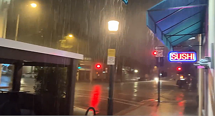
Heavy rainfall in Pasadena on Sunday night, Nov. 16, 2025. [John Antczak via X]
With increased traffic at the start of the work and school week and more rain on the way, a city official urges residents not to “let their guard down”
A brief morning lull in storm activity Monday is expected to give way to renewed and intensified rainfall across Pasadena and surrounding foothill communities, with the National Weather Service warning of advisory-level flooding, debris flows and hazardous travel conditions during the afternoon and early evening commute.
The forecast, issued by the NWS Los Angeles/Oxnard office at 3:29 a.m. Monday identifies a cold, moisture-laden storm system moving southeast into Los Angeles County.
Altadena and Pasadena, already saturated from historic weekend rainfall, faces elevated geotechnical and hydrological risks, especially in areas near recent burn scars in the San Gabriel foothills.
Meteorologists warn that the region’s saturated soil will amplify the impact of even moderate rainfall.
“It will not take as much rainfall to cause additional flooding/rockslides,” the NWS stated in its Area Forecast Discussion.
Rain rates are expected to peak between 0.25 and 0.50 inches per hour, with isolated convective bursts potentially exceeding 0.80 inches per hour. Thunderstorms are possible after 10 a.m., with a 99% chance of precipitation forecast for both Altadena and Pasadena.
The most critical hazard window is projected between noon and 7 p.m., when the cold front is expected to pass directly over the Los Angeles Basin. During this period, the probability of reaching debris flow thresholds in recent burn scars is estimated at 20–30%, according to NWS modeling. Pasadena’s proximity to steep terrain and fire-affected slopes places downslope neighborhoods at heightened risk.
Wind conditions, forecast to reach 10 to 15 mph from the southeast, may further destabilize saturated root systems, increasing the likelihood of downed trees and utility disruptions. Temperatures are expected to remain cool, with a high near 59°F and a low of 46°F.
Both Pasadena and Los Angeles County are offering residents free sandbags for pickup. Pasadena offers free sandbags for residents at a limited number of self-serve fire stations year-round. Residents can pick up up to 10 sandbags per person with proof of residency at Fire Station 37 (3430 E. Foothill Blvd.) and Fire Station 38 (1150 Linda Vista Ave.) between 8 a.m. and 5 p.m., while supplies last.
For Altadenans and those in County areas, pick up is at the Public Works Fleet Maintenance Yard, 252 Mountain View St. in Altadena..
Gov. Gavin Newsom said the state pre-deployed emergency response crews in Los Angeles, Orange and Ventura counties to enable faster response to any storm-related issues that develop. He said 274 personnel were being deployed, along with 18 engines, three Urban Search & Rescue companies, six bulldozers, three swiftwater-rescue teams, three helicopters and five dispatchers.
Pasadena remained in heightened staffing status Sunday.
“The Pasadena Fire Dept. has 13 Urban Search & Rescue personnel assigned to this storm and ready to respond locally or throughout the region if needed,” Pasadena Chief Communications Officer Lisa Derderian said early Sunday. “They also have been proactively patrolling the burn scar areas. Public Works and PWP also have extra staffing to be proactive and others on-call if needed.”
Forecasters urged homeowners to remain prepared for rain by ensuring gutters are cleared and windshield wipers are secure and working. They said people should consider rescheduling outdoor events, and advised motorists to avoid driving through flooded areas, as most flood deaths occur in vehicles.
Sheriff’s officials urged people to use websites such as Ready.Lacounty.gov to stay up to date on road closures, weather alerts, and emergency notifications.
City officials urge residents to avoid travel during peak storm hours and to monitor canyon roads and mountain passes for closures due to flooding or debris.
The NWS reported that the storm’s impact will persist into Monday night, with showers continuing and snow levels dropping to 4,500 feet by Tuesday morning.
A brief respite is expected Wednesday before another storm system arrives Thursday and Friday, prolonging the flood risk across the region.
Forecast for Pasadena from the National Weather Service as of 3:29 a.m.Monday:
Monday: A chance of rain, then rain and possibly a thunderstorm after 10:00 a.m. High near 61. Southeast wind around 10 mph, with gusts as high as 15 mph. Chance of precipitation is 80%. New rainfall amounts between a half and three quarters of an inch possible.
Monday Night: Rain and possibly a thunderstorm before 10:00 p.m., then a chance of rain between 10:00 p.m. and 4:00 a.m. Low around 43. West southwest wind 5 to 10 mph becoming southeast after midnight. Chance of precipitation is 80%. New precipitation amounts between a quarter and half of an inch possible.
Tuesday: A slight chance of rain and thunderstorms between 10:00 a.m. and 4:00 p.m., then a slight chance of showers and thunderstorms after 4:00 p.m. Partly sunny, with a high near 58. East wind around 5 mph becoming south in the afternoon. Chance of precipitation is 20%.
Tuesday Night: A 20 percent chance of showers before 10:00 p.m. Partly cloudy, with a low around 42. North northeast wind around 5 mph becoming calm after midnight.
Wednesday: Mostly sunny, with a high near 60.
Wednesday Night: Partly cloudy, with a low around 44.
Thursday: A slight chance of showers after 10:00 a.m. Mostly cloudy, with a high near 60.
Thursday Night: A chance of showers. Mostly cloudy, with a low around 46.
Friday: A chance of showers, mainly before 10:00 a.m. Partly sunny, with a high near 64.
Friday Night: A slight chance of showers. Partly cloudy, with a low around 45.
Saturday: Sunny, with a high near 68.
Saturday Night: Mostly clear, with a low around 48.
Sunday: Sunny, with a high near 70.
Altadena Calendar of Events
For Pasadena Events, click here